MountResilience.
Climate adaptation for resilient mountain landscapes and communities.
MountResilience connects European mountain regions to develop, test and transfer responses to climate change. Biodiversity Lab contributes GIS and participatory mapping to the Friuli Venezia Giulia replicator, with particular attention to sustainable mountain tourism and territorial planning.
Official project website ↗
Mountain regions on the front line of climate change.
Increasing temperatures, changing snowfall and precipitation patterns, water availability and extreme-weather risks have consequences for mountain ecosystems, infrastructure, local economies and tourism. Adaptation strategies must respond to these connected challenges while reflecting each region's environmental and socioeconomic conditions.
Coordinated by UNIMONT at the University of Milan, MountResilience brings together 47 partners from 13 countries. It develops practical, transferable adaptation approaches through interdisciplinary research, nature-based solutions, technological innovation and stakeholder participation.
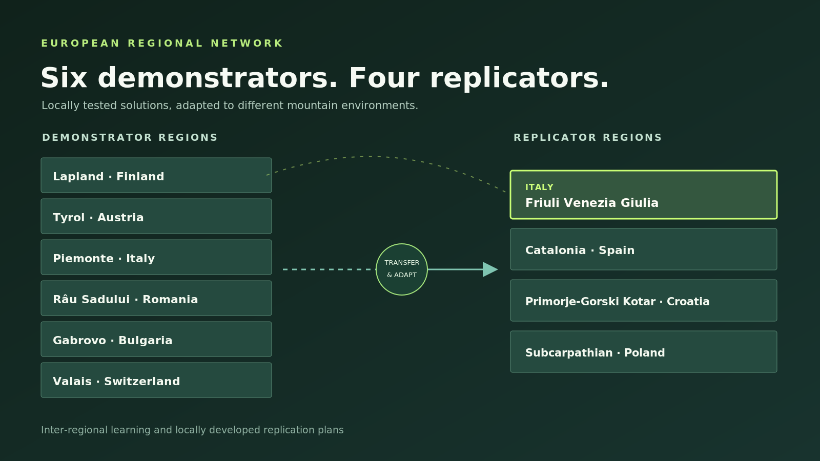
Six demonstrators. Four replicators.
Demonstrator regions develop and test locally relevant solutions. Replicator regions adapt the methods and lessons to their own mountain territories.
Friuli Venezia Giulia.
Climate adaptation in the north-eastern Italian Alps.
Friuli Venezia Giulia participates as a replicator region, developing a strategic and governance-oriented replication plan for Alpine and Pre-Alpine territories. The current pathway works across three scales: testing locally in Val Pesarina, assessing transferability across Carnia, and identifying routes for integration into wider regional climate and mountain-development policies.
The local context makes this especially relevant. Reduced snow reliability, changing water availability, biodiversity loss, changing tourism patterns and the long-term viability of mountain communities are not separate problems: they interact. Replication therefore connects environmental evidence, local knowledge, stakeholder priorities and lessons from MountResilience demonstrators in Lapland, Tyrol and Valais.
Connecting spatial evidence and local knowledge.
The University of Trieste participates through the Ciamician interdepartmental Centre, involving both the Department of Engineering and Architecture and the Department of Life Sciences. Within this framework, Biodiversity Lab develops the natural-environment, GIS and participatory-GIS contribution, with a particular focus on how biodiversity evidence can enter the replication plan for Val Pesarina and the wider Carnia territory.
Climate-sensitive landscapes
Integrating trails, habitats, species records, invasive plants, ecosystem information and climate scenarios to identify vulnerable locations and biodiversity priorities.
Local and visitor knowledge
Exploring interactive mapping to capture how residents and tourists use mountain places, what changes they perceive and where tourism pressure and environmental sensitivity overlap.
From Lapland to Val Pesarina
Assessing how the participatory approach developed by the Lapland demonstrator can be adapted to the geography, biodiversity, governance and tourism context of the Carnic Alps.
Replication and adaptation planning
Turning citizen observations, expert validation and spatial evidence into maps and indicators that can support locally accepted adaptation options, resilient trails and nature-based tourism.
From Lapland to the Italian Alps — by adapting, not copying.
Replication is not a direct transfer of a demonstrator solution. The current Friuli Venezia Giulia pathway evaluates which elements can work under different climatic conditions, tourism systems, institutions and local priorities.
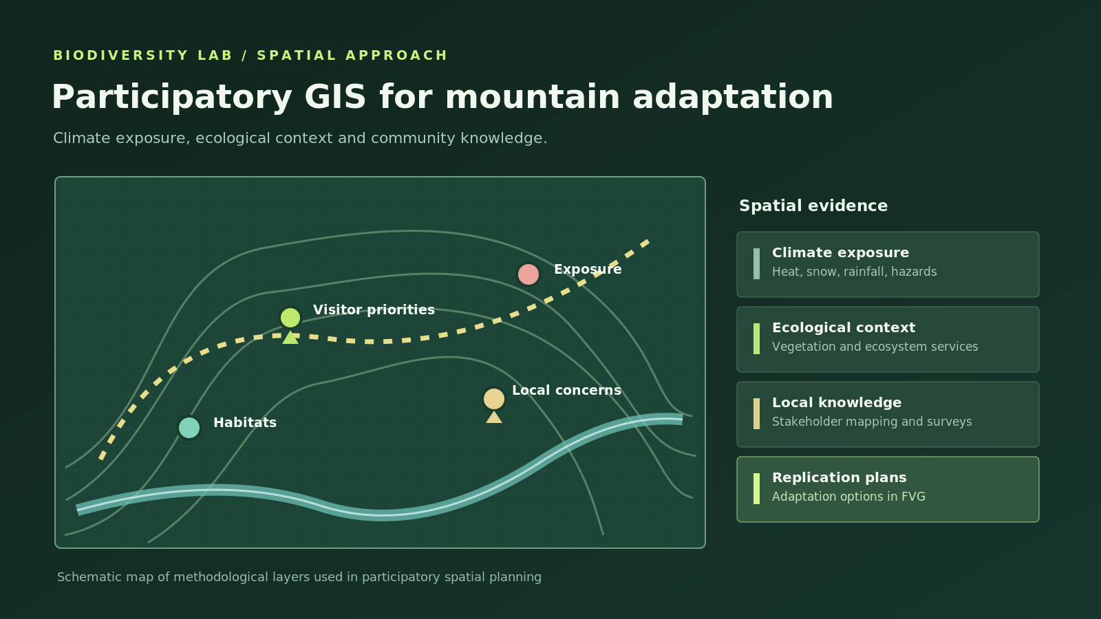
For Biodiversity Lab, the Lapland PPGIS experience is a methodological starting point. The proposed adaptation for Val Pesarina would combine community observations, expert knowledge, biodiversity layers and climate scenarios, while explicitly examining the different ways in which local residents and visitors use the mountain landscape. The aim is to understand where recreation, biodiversity sensitivity and climate exposure interact — and where that evidence can support better adaptation decisions.
From observations on the trail to climate-adaptation evidence.
The Department of Life Sciences is exploring a locally adapted participatory-GIS workflow that can connect community observations with biodiversity and climate information.
Plan routes & places
Identify trails, tourism nodes and mountain areas where local use, visitor use and environmental sensitivity can be compared.
Collect observations
Use participatory mapping and citizen-science observations — potentially including iNaturalist — to record perceived changes and biodiversity signals.
Validate with experts
Combine public observations with botanical expertise, habitat information and targeted biodiversity datasets.
Integrate in GIS
Link species and habitat records with trails, tourism intensity, climate information and other spatial layers.
Build decision layers
Develop maps of vulnerable locations, climate-sensitive biodiversity, invasive-species signals and priority routes for resilient nature-based tourism.
Linking landscapes, livelihoods and communities.
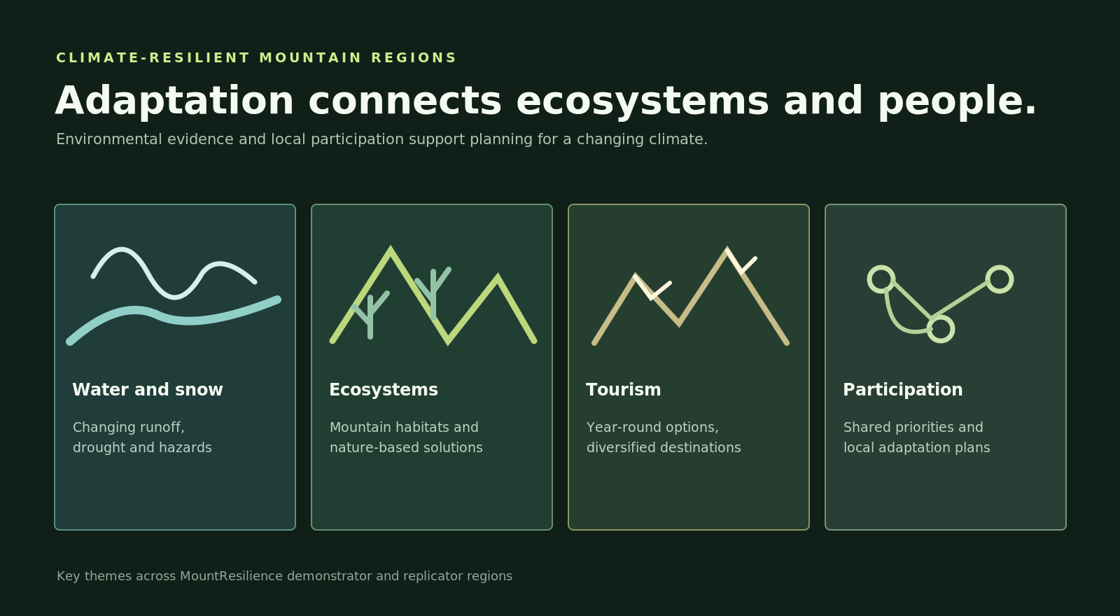
Mountain resilience involves environmental management and the people and activities that depend on functioning mountain ecosystems.
European cooperation with a regional focus.
The University of Milan's UNIMONT centre coordinates the European consortium. In Friuli Venezia Giulia, the regional replication context brings together the Autonomous Region and research contributions from the University of Trieste.
Val Pesarina: testing the replication plan on the ground.
A MountResilience replication visit brought the regional team, University of Trieste, the Carnia Mountain Community and project replication partners together in Tolmezzo and Val Pesarina to discuss climate-adaptation needs, local initiatives and the transferability of demonstrator solutions.
The day connected the replication plan with real places and actors: the Pradibosco winter-tourism area, local economic operators and the cultural and natural assets of Pesariis. For Biodiversity Lab, it provided a concrete setting in which to discuss how a participatory PPGIS could link biodiversity, climate change and different patterns of mountain use by residents and visitors.
Read the field-visit story ↗