Lae Kumbhi
Hydropower.
Critical habitat assessment, a Biodiversity Action Plan and quantitative connectivity analysis to inform mitigation and ecological offsets in Sumatra.
Explore the ecological analysis ↓Biodiversity safeguards in tropical landscapes.
Since 2024, Giovanni Bacaro has contributed as International Biodiversity Key Expert to an international environmental consultancy team working with ELC Electroconsult on the Lae Kumbhi hydropower project in the Subulussalam area of Sumatra, Indonesia, at the regional interface of Aceh and North Sumatra.
His work brings together environmental impact assessment, Critical Habitat Assessment, the Biodiversity Action Plan (BAP) and application of the mitigation hierarchy. An important component is the development of a biodiversity-offset strategy for residual impacts, using field ecology, satellite imagery and quantitative spatial analysis.
Explore our collaboration with ELC ↗From survey data to offset strategy.
Specialist technical coordination and field-based biodiversity expertise integrated with Earth observation and quantitative habitat modelling.
Biodiversity assessment
Coordination and specialist support for floristic and vegetation surveys and analysis of potential hydropower-related ecological impacts.
Critical Habitat Assessment
Analysis of critical habitats as part of the environmental assessment and biodiversity-safeguard framework.
Biodiversity Action Plan
Technical coordination and development of the BAP to structure biodiversity management actions.
Mitigation hierarchy
Assessment of avoidance, minimisation and restoration approaches, followed by consideration of residual impacts requiring offset measures.
Habitat and land-use mapping
Classification from high-resolution satellite imagery, validated using ground-based floristic and vegetation observations.
Connectivity and offset design
Quantitative ecological-connectivity analysis to inform restoration, afforestation and biodiversity-offset site and strategy options.
Animal Encounter Protocol
Technical support to the protocol and associated environmental data interpretation.
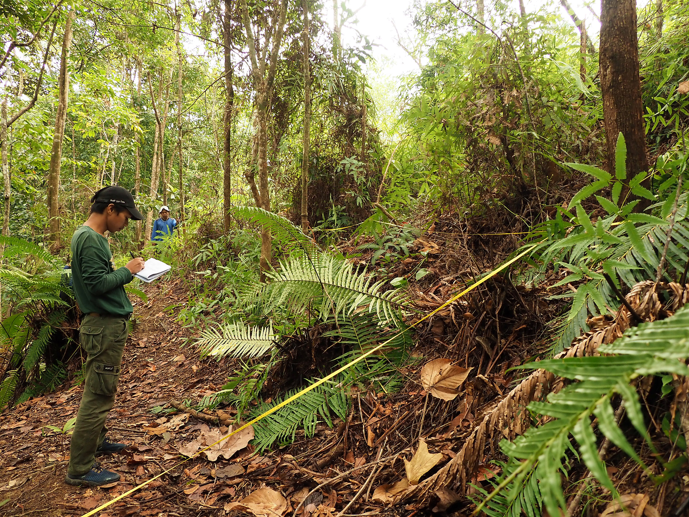
Habitat maps validated in the field.
Land-use and habitat classifications based on high-resolution satellite images were checked against field observations collected during floristic and vegetation surveys.
These data underpin the evaluation of biodiversity impacts and support a more explicit spatial treatment of habitat quality and landscape connectivity within the mitigation and offset-planning framework.
Connectivity informs offset design.
Landscape connectivity was evaluated to support comparisons among potential offset and afforestation strategies. The examples below illustrate how movement-potential classes and an associated relative wildlife index can be interpreted alongside ecological field data.
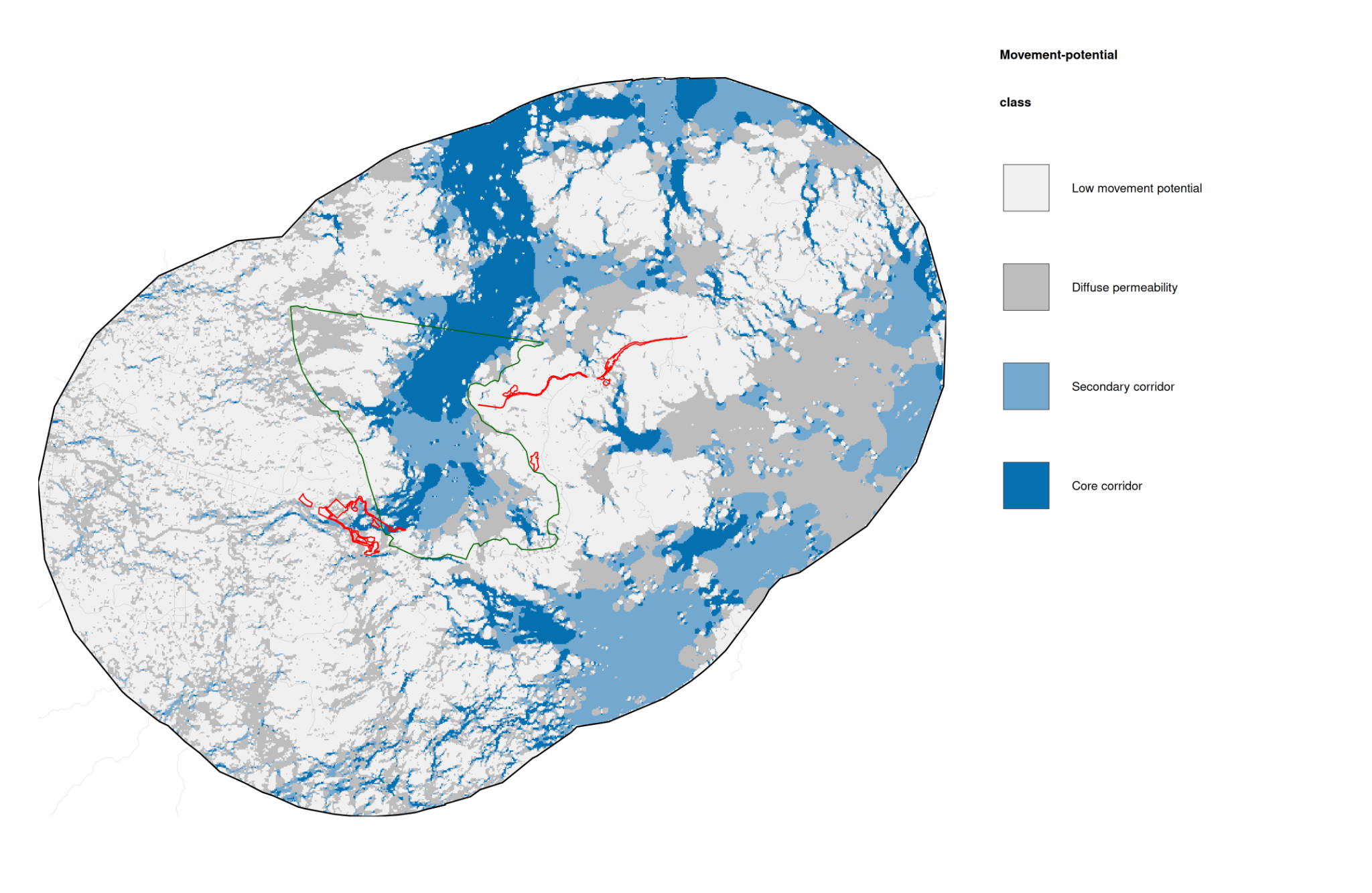
01 / Wildlife movement potential and habitat connectivity
Modelled movement-potential classes used to compare connectivity and ecological offset planning scenarios. The diagram retains its original classes, boundaries and legend.
View figure at full resolution ↗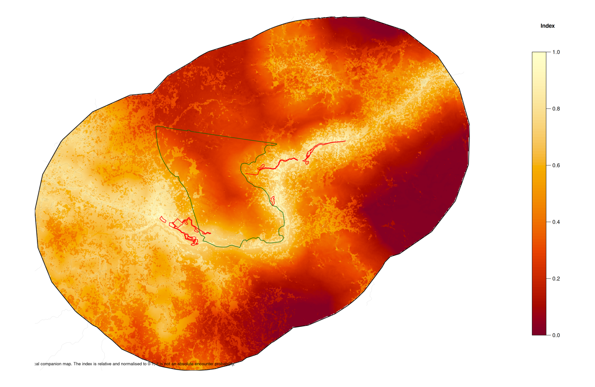
02 / Relative wildlife encounter index
A preliminary, continuous index normalized between 0 and 1; it is relative and must not be interpreted as an absolute encounter probability.
View figure at full resolution ↗These figures support exploratory and quantitative comparison of ecological scenarios. The displayed risk index is relative, not an absolute wildlife encounter probability. Strategy development is ongoing; illustrations do not establish that a particular offset or afforestation intervention has been approved or implemented.
Inside Sumatran forest ecosystems.
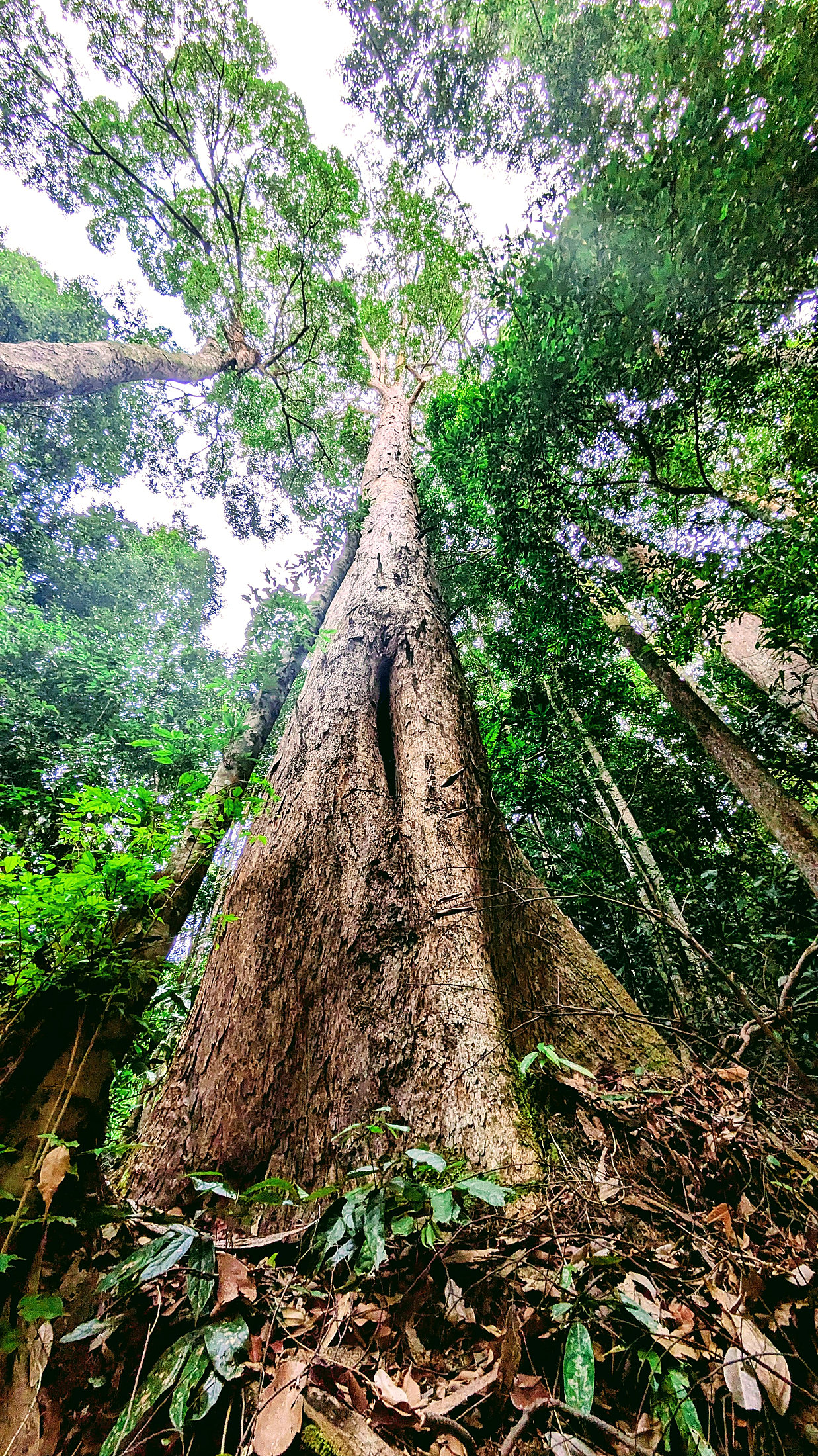
A photographic archive of tropical landscapes, rainforest vegetation, wildlife observations, field surveys and local coordination. Browse the photographs using the arrows or thumbnails.
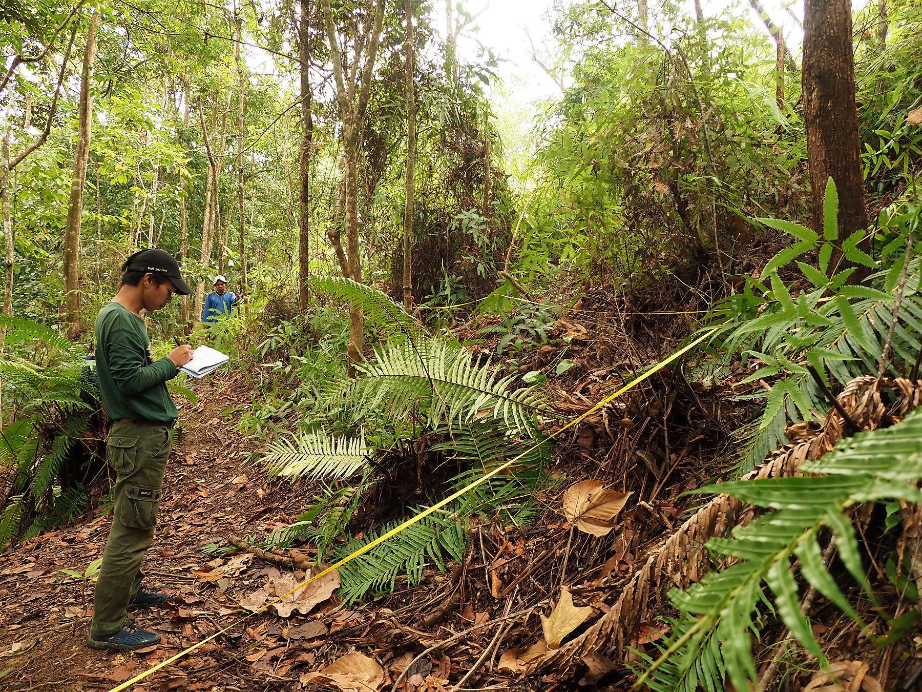
Publication copies are optimized for the web and stripped of camera GPS and other EXIF metadata. Individual species identifications and precise survey coordinates are intentionally omitted until verified and cleared for publication.
Evidence for measurable ecological outcomes.
Lae Kumbhi illustrates how biodiversity impact assessment can connect ecological field evidence with spatial modelling to evaluate residual impacts and develop an evidence-based offset strategy. It complements our consultancy on forest and watershed planning in Nepal and plant diversity and wetland mapping in Lesotho.